Thursday, October 13, 2016

Moosilauke via Gorge Brook Trail (10/8/16)

The mountain: Mt. Moosilauke (4802')
The route: Gorge Brook Trail -> Moosilauke Carriage Road -> Snapper Trail
Total hike time: 4 hr, 50 min (~45 min breaks)

Well I was not planning on going up to NH again this year, but the urge struck, and after realizing that Columbus Day weekend and a Badger bye week intersected, it seemed like the fates had aligned for one last summit before the winter hit. I invited my good friend Brenna, a native Vermonter and someone who I've been meaning to hike with for quite awhile. After some debate we decided against doing Cannon (assuming the leaf peepers would be rampant) and picked Moosilauke as our summit of choice. I would love to go back and do this one via the Beaver Brook Trail, which is supposed to be somewhat more challenging, but we chose to go the "calmer" route for various reasons. We drove up to NH Saturday morning and hit the trail by 10. I was positively giddy because I had somehow convinced myself that the foliage wasn't going to be out...OH BUT IT WAS! Having never seen the mountains in their colors, I was completely delighted and could barely contain myself as we drove to the trailhead.


We started off on the Gorge Brook trail and had to do a little bit of work to get past a large, and somewhat underprepared looking group of college students who were already complaining about their knees and looking for extra hair ties within 10 minutes of getting on the trail. One minor bit of drama happened about 20 minutes up the trail when I got stung by a bee! There was a nest in a tree trunk that I was completely oblivious to and next thing I knew I felt the familiar sensation of being stung (it's only happened once before, but thankfully I know I'm not allergic). Oh well. Onward and upward. Compared to the other trails I've hiked in the Whites this one was fairly easy - some sections of more steady uphill grade and rock stairs, but nothing too taxing. We enjoyed the quiet of the forest and took in the sights.
Fairy garden of mushrooms and ferns

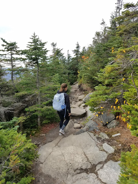
Hiking is fun! (Note the actual dirt trail...not something I've ever seen before up here!)

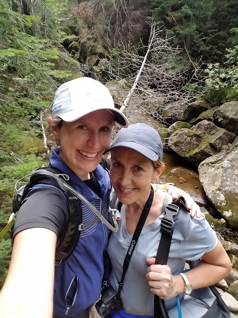
Soon enough we came to an overlook that we immediately knew would be where we'd be having a snack. It was the first real glimpse of the view to come and I have to say - if you're looking for a high bang for your buck hike...Moosilauke has got the goods. I was already contemplating how to convince my mom to try another hike (I promise, Mom, this one is ACTUALLY moderate!) before we were even halfway up the mountain.

The trail continued up and began kind of curling along a ridge - there was one section that got a little bit steeper here and we really thought we were approaching the summit. Not quite, but once you get over the steep hump the remainder of the hike is quite a bit more gradual. I have to say I'm a little bit obsessed with the approach to the summit up there, though. First you get gorgeous views through the trees as you walk along the ridge...


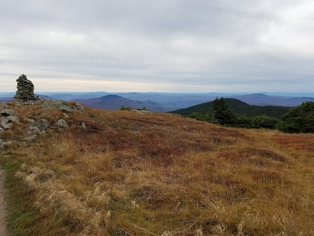
Then, to my surprise, the trail opened up into this incredible alpine field! Walking the trail through the field was incredibly cool - completely a different experience than scrambling up to a rocky summit, but extremely awe inspiring all the same. The whole climate is completely different than anything I'd ever seen, and there were plenty of signs warning to stay on the trail in order to protect rare plants nearby. 
 Stunning trail coming up the ridge
 No scrambling needed here!

Shortly we were at the summit and took a break for lunch - pepperoni, cheese, crackers, apples, and some gummis - hit the spot! The wind was definitely noticeable at the top and we were happy to be able to shelter in a little wind block someone had built. There were a fair number of people at the summit, maybe 20-30, but the summit area is very large so it didn't feel crowded. Lots of cute dogs up there...this would be one I'd maybe try with Dayton, as there wasn't anything too scary that I felt like I'd have had trouble managing him. I will admit we were a little confused, as "book time" to the summit was 3 hours. We made it up in right about 2 hours, and that was with a 10 minute snack break! So...I guess we are just really fast hikers? 
4000 footer #6, yeah!

 Arabesques at the summit, as you do 
The lunch hole hahaha

After refueling and taking some pics we headed off down the ridge for the descent. The views continued to be spectacular throughout - I'll admit they would have been even more incredible had it been sunny, but I was thrilled that the clouds were staying high enough that we were at least getting the view we came for! At the intersection of the ridge trail with Carriage Road, which would take us back down, there was a spur trail to South Peak...well...how could we refuse? I was really glad we decided to check it out, because despite only having 180 degree views, they were STUNNING, we had great views back to Moosilauke, and we had a decent about of time with the summit completely to ourselves! And we took advantage...


Self timer jumping photo was...uh...not successful hahaha

The hike down was uneventful. I think the Carriage Road probably would have been rather boring ascending, but descending it was quite nice as you got to continue enjoying the views pretty much all the way until you got to the intersection of the Snapper Trail. We spent a lot of this time discussing our upcoming company dance show and planning for that - a productive and fun hike! Soon enough we were back at the junction of Snapper and Gorge Brook trails, successfully avoided the bee nest on the way back, and were back where we started! 

We went to the Common Man in Lincoln for lunch/dinner, where I had a delicious Moat Mountain blueberry beer, a burger, and we split this insane salted caramel sundae - basically PERFECT refueling food! We were thankful that we ate in NH, because after driving for about 45 minutes, we spent the next 2.5 hours looking at approximately this:
Well..I guess you don't have too many opportunities to take photos while behind the wheel of a car on the highway? 

Apparently a bus had caught fire earlier in the day and the interstate had been completely closed - as it was, we spent 2.5 hours going maybe 3 miles. We kept ourselves entertained by rolling the windows down, blasting the Hamilton soundtrack, and living our dream of finally yelling at the top of our lungs "EVERYONE GIVE IT UP FOR AMERICA'S FAVORITE FIGHTING FRENCHMAN!" during Guns and Ships. Good times were had by all.

Overall, this was a really nice hike. Because it was easier than really any of the hikes I've done before (I didn't exactly start with level 1 hiking...oops) it didn't quite give me the rush that I've gotten used to getting when I have to conquer my fear of being in a high place or scrambling up some crazy rocks. However, the views from the summit, particularly with the foliage, were awe inspiring, and the alpine field made for a really unique hiking experience. I definitely think I'll find my way back to Moosilauke, maybe via the Beaver Brook Trail next time. As it was, it was a great way to end the 2016 hiking season - 4 4000 footers is certainly more than I expected to summit this year! I'm excited about the discovery that some hikes are totally doable in a day trip and about my spur of the moment decisions to go back up there in September and October. My goal for next year is to get at least 8 peaks (though really I'm shooting for double digits) and to get up to NH at least once a month from May through October. Ambitious goals, but I love being in those mountains so much that I absolutely can't wait! I'm not a winter hiker, so I probably won't have much to report until the spring. Until then, stay wild. :) 

Thursday, September 22, 2016

Flume/Liberty Loop via Flume Slide Trail 9/20/16

The Mountains: Mount Flume (4328'), Mount Liberty (4459')
The Route: Whitehouse Trail -> Flume Slide Trail -> Franconia Ridge Trail -> Liberty Springs Trail 
Total hike time: 7 hr, 40 min (~40 min breaks)
Summit beer: Rising Tide Maine Island Trail Ale (FINALLY remembered to bring one)

A few weeks back in the midst of a couple of weeks of hell that included being swamped at work AND moving (ugh), I decided a couple of mental health days were in order and requested a couple of days off for a long weekend at work. At the time I had no idea what exactly I was going to do with said days off, but the idea of heading up to the Whites for at least a day came to mind almost immediately. I initially had planned on doing a solo hike but I somehow found myself researching the Flume Slide trail, got completely invested, but also knew there was no way I was doing that one solo. As it happened, a "friend" (long story) of mine happened to mention that he'd be willing to come with me, and after some hemming and hawing I eventually accepted because the goal of conquering the Flume Trail had pretty much consumed me. So at 5:30 am on Tuesday, I found myself not waiting for my alarm to go off to go to work, but driving up the the Whites. Pretty much an ideal scenario for a Tuesday. 

Low clouds in the morning

We arrived at the Liberty Springs parking lot just after 8 and by 8:20, we were off on the trail. The first mile or so of the trail is sort of silly in comparison to the rest but it was a nice warmup, and would prove to be a nice cooldown later. We began with a 0.9 mile jaunt on the Whitehouse Trail, which also includes some walking on a bike path. Given that this was the first double digit hike we'd attempted and the stories I'd heard about the slide, I was OK with an easy and brisk paced start.
Also, not every day you see this while walking on a bike path...

We reached the bridge that marked the junction for Liberty Springs Trail, and I could feel my excitement mounting. I'm going to climb a mountain instead of being at work today! Yippee!!
That's a gleeful smile right there

The hike got off to a fairly gradual start, just trekking through the beautiful woods. Sunbeams were flickering in and out of the trees and I was once again struck with how much I love being out here in the mountains. As someone who grew up in the midwest I don't think I'd have ever guessed I'd become someone who loved hiking mountains, but we'll just add that to the list of things I never expected I'd love (ahem..marathons). We quickly reached the junction of Liberty Springs and Flume Slide, and now it was decision time. My excitement over the slide had given way to more realistic fear over the course of the morning, especially given the fact that it had rained the last couple of days and basically everything I'd read about the trail stated something to the effect of ONLY DO THIS IF IT'S DRY. But it was a gorgeous, sunny day today, and in the end, I knew I was only going to choose the path of most resistance. So right, and up the Flume Slide we went!


The beginning of Flume Slide was quite lovely, although both of us found ourselves asking "uh...aren't we supposed to be going UP?" Compared to our previous experiences in the Whites the beginning of this trail was like a walk in the park! Of course, we knew that the section that really mattered was yet to come. We ran into the first people we'd seen all day at a river crossing; a couple also headed up to Flume. Shortly after, Andrew mentioned that he thought maybe we were supposed to cross the river on the left. I wasn't sure and it certainly looked like the trail went straight...so we went straight. However, after a somewhat ridiculous bushwhack up a muddy ledge we all quickly realized that this was not, in fact the trail. I pulled up my map and realized that there was a pretty quick right/left/right river crossing, so that cross to the left was definitely the right way to go! Once across the river again we were slightly disconcerted by the lack of blazes, but the width of the trail and the lack of encroaching trees was a pretty good sign that we were back on track. Onward and upward!
Just off the trail after the confusing crossing. "Whenever I see something like this, I feel like I've discovered magic" is what I said about this place.

Finally, it started to feel like were were starting to climb a bit. The trail began to get rockier, with dirt becoming less and less apparent. After the easier section, I definitely felt the heart rate start to climb a bit more and was happy I'd gotten rid of my arm warmers - it was a gorgeous temperature, but a bit humid. We stopped for a quick Honey Stinger break before continuing upwards to the infamous slide.
Up. The trail is going up.

Things kept getting rockier and I kept finding myself wondering OK, just where exactly is this slide? Because if it keeps on like this I can TOTALLY handle this. No sooner did I think that that we came up on the first steep slab, and it was go time. Now Andrew, as it turns out, is part mountain goat and was happily hopping, scrambling, and throwing himself from hold to hold. I took a much more conservative approach and took my sweet time finding whatever I felt to be the optimal path. The first couple of big slides were just straight up fun - plenty of good hand and footholds but certainly steep enough that you might not want to think too hard about what's behind you. I was happily patting myself on the back for my absence of fear in this situation. AND THEN we reached the slide that was my nemesis. Andrew scurried on up as usual, and I tried my best to find a path. The rock was wet, slippery and basically flat without a hand hold to be found. You know those videos where a dog tries to run up a slide? That was basically how I felt, except if I fell backward down the slide I was in big trouble. I was aware that there were bailout trails off to the side but I had come here to do the damn slide and I was going to do it. After trying at least 3 different ways up the middle, all of which resulted in my getting stuck and uttering a few choice words, I saw something resembling a route on the far right side where I figured I could benefit from using the tree trunks and branches over there. I did benefit, sort of, although not without a few terrifying moments wondering how I was ever going to get out of my current position.  "I'M BEING A TERRIBLE STEWARD OF NATURE!" I yelled mournfully after getting stuck somewhere in the branches of yet another pine tree. But eventually, with a few dicey moves, I found my footing. After what felt like ages, or possibly 10 minutes, I FINALLY made it up onto some semblance of a ledge.
Hey, that looks like a fun waterslide! Oh wait that's the trail. And we're on a mountain.

I needed a couple of minutes to compose myself, but after that I figured nothing could be as bad. The rest of the trail was for the most part just a delightful, fun, adrenaline fueled extravaganza. I certainly used my share of tree trunks but I also had quite a lot of fun "rock climbing" and using my body in all sorts of fascinating ways to pull myself up. Somewhat amazingly, I was rarely scared at all - mostly just filled with the exhilaration of doing something crazy. I think stuff like this is the closest to extreme sports I'll ever get.
"Easier" section

This is what we came for!

At long last, things started to calm down a bit and we finally made it to the sign marking the junction with Franconia Ridge Trail, and therefore indicating that we had survived the slide! I was very excited, very proud of myself, and feeling very badass.
BAMFs.

Of course, the slightly ridiculous thing was that we still weren't even out of the trees, nor had we summited a mountain yet! So of course now it was time to do those things. We headed up the short spur to the Flume ledges, and as soon as Andrew popped out of the trees he said "I know where we're having lunch!"

I dub thee Sandwich Rock. Andrew is slightly more daring than I. 

The hike up the Flume Ledges was delightful, and I was once again pleased that my acrophobia decided to stay quiet. The views out to the left were absolutely stunning, and at a couple points the trail would just drop away into a ravine. I stayed quite far away from the side of the trail on those ledges, but the views were still amazing.  We continued on up to what we assumed was the summit of Flume - no cairn or sign, but a fairly obvious summit - took in the views for a few minutes, and then continued on down the trail into the col. Up until this point we hadn't seen a soul since our friends at the complicated river crossing, but we started to pass a few people in between the two mountains. By a few, I mean maybe 5...perks of going up on a random Tuesday.  The ridge trail was in the trees and made for a fairly relaxing break after the trek up the slide. We ambled along, enjoying the sunshine and the day which had turned out to be absolutely gorgeous. Going up to the summit of Liberty there were a few fun and funky little scrambles, including one interesting one where you had to hop up onto a large, slanted rock and creep your way along the top. Surprising even myself, I chose to just walk across once I got up and had something to rest my hand on. Andrew chose a different approach..
"Ta da!"

And soon enough, we were at the summit! I had read overwhelmingly positive things about Liberty and on this gorgeous day, it did not disappoint.
 Wait...we came from there?
 Gazing over the Cannon cliffs
 Finally remembered to bring a summit beer
 I enjoyed this rock with the crack
 Can I stay forever? 
Just...yup
Sometimes you have to take advantage of the opportunity to arabesque on a mountain

There were only 3 other people on the summit, a couple with an adorable dog and a guy who we had leapfrogged with a couple of times in the col who said he was doing a 4 day Pemi loop. He also said he envied our daypacks...I can imagine! I could have probably stayed on the summit all day but alas, this was only a day trip and we had several more miles of hiking to go. The way down is never as exciting as the way up, but it was still a lovely and relatively pleasant descent - definitely a consistent stair stepper of a trail, but didn't feel as technical or hard as the descent from Jackson a few weeks back (sorry, mom). We hiked through the tentsite which was cool; someday I'd love to make more of a foray into backpacking but I think I'll probably start with the huts if I'm planning any overnight trips in the near future. We also partook in the time honored Halfway Down Meat Stick Break and I enjoyed my favorite mountain descent tradition of finding a pretty pool and putting my feet in it. After a couple of hours of descending, we were back on the ground - it's always a little hard coming back to reality after being in such a spectacular place, but we were both extremely proud of our accomplishment and I felt more relaxed than I had in weeks.
Post hike happiness!

All in all, this was a glorious hike. There was also something just so delightful in realizing that if I pick my hike right, I can actually day trip up from Boston...I think that means I'll be spending a LOT more time in the Whites in the years to come. I can't say I'm antsy to do the Flume Slide again anytime soon, but Liberty was so magical that I'd totally be up for doing those two mountains again via a different route. And yet...48 mountains is a lot, and I have many left to climb! So we'll see if any summits get repeat performances.  When's the next one??

Saturday, August 6, 2016

Mount Jackson - 8/6/16

The Mountain: Mount Jackson (4052')
The Route: Webster-Jackson Trail
Total hike time: ~5:30

When my mom decided to come out to the east coast for a weekend in NH, it was obvious that we had to do a hike. I plugged "moderate" into AllTrails and found a wide variety of options...Moat Mountain, Mount Willard, and at least one other all made the short list. However, one option just kept calling me back because it was a 4000 footer...and that was Mount Jackson. So in keeping with my tradition of dragging unsuspecting parents up large mountains, my mom's first EVER true hike was to be a White Mountain 4000 footer. What could possibly go wrong?

We stayed in North Conway and were up bright and early for the drive to Crawford Notch. With the potential for thunderstorms in the forecast for the afternoon I wanted to be on the trail ASAP, and right on schedule we pulled into the Highland Center parking lot at 7:15. After a little bit of confusion trying to find the trailhead (it's on the side of the road with the lake, but past the lake - it just kind of dives into the woods and if you didn't know it was there, you'd miss it), we were trekking off into the woods! I was filled with excitement to be back in the mountains and to get to show my mom what I love so much about this place.
Here we goooo!

Mom's learning quickly

In standard White Mountain fashion, the "moderate" nature of this trail was a touch questionable, and early on I definitely wondered if I'd made the right choice. A pretty consistent uphill grade quickly gave way to a stairmill of boulders and rocks to climb over. My mom's reaction to this was somewhat funny. I definitely know EXACTLY what she was expecting when I mentioned hiking because it's exactly what I thought of as hiking before I was introduced to New England mountains - a nice, groomed footpath up the side. Clearly she got a bit of a rude awakening upon finding out that "trails" in the mountains are a lot more rugged than you might expect! Still, we kept the pace easy and were having a great time. The weather was beautiful, with the humidity of the morning starting to burn off sunbeams started flitting through the trees, creating a gorgeous scene. 

She's a trooper

Not too much to say about most of the ascent - in my limited experience, it was a pretty standard rocky fun time of a White Mountains trail! There were a couple of bigger river crossings which both of us managed to make it through without taking a dive. As we approached the summit, things started to get rockier and steeper...suddenly, out of nowhere, we came up on a huge scramble! I had heard a little bit about the fact that the very end of Jackson was a little challenging, but I'll admit I wasn't quite expecting this. After the first big scramble, Barb decided that she'd gone as far as she could - definitely the smart move. I asked if it was OK if I kept going because I had the feeling the summit was close and I couldn't stand the thought of missing out on a summit having already come so far. She told me to go, and with that I headed up the remainder of the scramble. As predicted the summit WAS close, although I didn't realize I was going to have to scramble up a pretty steep slab to get there. I've never done any part of a hike totally alone, and while I was worried that my fear of heights would kick in at any moment, the feeling of doing this - of climbing a mountain on my own - was nothing short of exhilarating. I made my way up the steep slab and was finally greeted by a cairn as well as a couple of other hikers (the first people I'd seen all day) on their way down off the summit. I asked that if they saw a woman hanging out down the trail by herself that they tell her her daughter was at the summit and fine (as it turns out my mom did have somewhat of a panic attack thinking I'd somehow gotten myself killed on the way up to the summit, so I was glad they were able to ease her fears sooner!) and then proceeded to spend a few gorgeous minutes with the summit of Mount Jackson belonging only to me.
Top of the world

'
Ascent to the top; slightly steeper than I'd expected but good prep for the future I'd say!

The best feeling. #3!


My time on the summit seemed too short but I knew I had to get back down to Barb before she went completely crazy. I scrambled back down with a grin on my face. As for my mom, she was thrilled herself to have made it as far up the mountain as she did! I know for her it wasn't so much about summiting but sharing the day with me, and I was thrilled to be able to share it with her too. 

The hike down was pretty uneventful. My mom was definitely starting to get fatigued and took a couple of spills on the big rocks on the way down, but nothing major. She also wound up with a black toenail probably due to the relentless descent...oops, sorry mom! Luckily I had ibuprofen and tape and we made it down just fine, stopping a couple of times to rest by the beautiful streams on the way. 
 Happy times
 Pausing at the river crossing
Success! And only slightly worse for the wear. 

All in all it turned into a beautiful day for a hike - the rain held off completely and by the time we got back to the car it was quite a warm day with plenty of sunshine! We celebrated our accomplishment in the only appropriate way possible: with burgers and beer at Moat Mountain Smokehouse. This was the hike that officially cemented my goal of completing the NH 48 - I've got a long way to go but am excited about the journey! As for my mom, not sure she's gunning to climb another mountain any time soon, but I'm really proud of her for toughing it out!